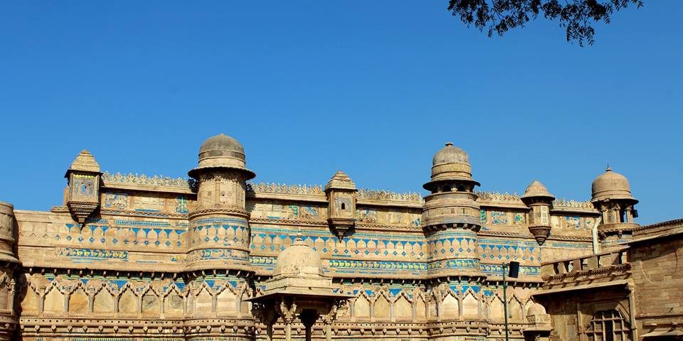
Information about Madhya Pradesh
| Capital | Bhopal |
|---|---|
| Largest city | Indore |
| Districts | 51 |
Madhya Pradesh is a state in central India. Nicknamed the “heart of India” due to its geographical location in India, Madhya Pradesh is the second-largest state in the country by area. With over 75 million inhabitants, it is the fifth-largest state in India by population. It borders the states of Uttar Pradesh to the northeast, Chhattisgarh to the southeast, Maharashtra to the south, Gujarat to the west, and Rajasthan to the northwest. Its total area is 308,252 km2. Before 2000, when Chhattisgarh was a part of Madhya Pradesh, Madhya Pradesh was the largest state in India and the distance between the two furthest points inside the state, Singoli and Konta, was 1500 km.
Madhya Pradesh represents great river basins and the watershed of a number of rivers. Catchments of many rivers of India lie in Madhya Pradesh. Several cities in Madhya Pradesh are extraordinary for their architecture and or scenic beauty. Three sites in Madhya Pradesh have been declared World Heritage Sites by UNESCO.
History
Isolated remains of Homo erectus found in Hathnora in the Narmada Valley indicate that Madhya Pradesh might have been inhabited in the Middle Pleistocene era. Painted pottery dated to the later mesolithic period has been found in the Bhimbetka rock shelters. Chalcolithic sites belonging to Kayatha culture (2100–1800 BCE) and Malwa culture (1700–1500 BCE) have been discovered in the western part of the state.
Chandragupta Maurya united northern India around 320 BCE, establishing the Mauryan Empire, which included all of modern-day Madhya Pradesh. Ashoka the greatest of Mauryan rulers brought the region under firmer control. After the decline of the Maurya empire, the region was contested among the Sakas, the Kushanas, the Satavahanas, and several local dynasties during the 1st to 3rd centuries CE. Heliodorus, the Greek Ambassador to the court of the Shunga king Bhagabhadra erected the Heliodorus pillar near Vidisha.
The Medieval period saw the rise of the Rajput clans, including the Paramaras of Malwa and the Chandelas of Bundelkhand. The Chandellas built the majestic Hindu-Jain temples at Khajuraho, which represent the culmination of Hindu temple architecture in Central India. The Gurjara-Pratihara dynasty also held sway in northern and western Madhya Pradesh at this time. It also left some monuments of architectural value in Gwalior.
After the independence of India, Madhya Pradesh was created in 1950 from the former British Central Provinces and Berar and the princely states of Makrai and Chhattisgarh, with Nagpur as the capital of the state. The new states of Madhya Bharat, Vindhya Pradesh, and Bhopal were formed out of the Central India Agency. In 1956, the states of Madhya Bharat, Vindhya Pradesh, and Bhopal were merged into Madhya Pradesh, and the Marathi-speaking southern region Vidarbha, which included Nagpur, was ceded to Bombay state. Jabalpur was chosen to be the capital of the state but at the last moment, due to some political pressure, Bhopal was made the state capital. In November 2000, as part of the Madhya Pradesh Reorganization Act, the southeastern portion of the state split off to form the new state of Chhattisgarh.
Geography
This state is located in the geographic heart of India, between latitude 21.2°N-26.87°N and longitude 74°02′-82°49′ E. The state straddles the Narmada River, which runs east and west between the Vindhya and Satpura ranges; these ranges and the Narmada are the traditional boundary between the north and south of India. The highest point in the state is Dhupgarh, with an elevation of 1,350 m (4,429 ft).
Climate
It has a subtropical climate. Like most of north India, it has a hot dry summer (April–June), followed by monsoon rains (July–September) and a cool and relatively dry winter. The average rainfall is about 1,371 mm (54.0 in). The southeastern districts have the heaviest rainfall, some places receiving as much as 2,150 mm (84.6 in), while the western and northwestern districts receive 1,000 mm (39.4 in) or less.
Ecology
According to the 2011 figures, the recorded forest area of the state is 94,689 km2 (36,560 sq mi) constituting 30.72% of the geographical area of the state. It constitutes 12.30% of the forest area of India. Legally this area has been classified into “Reserved Forest” (65.3%), “Protected Forest” (32.84%) and “Unclassified Forest” (0.18%). Per capita forest area is 2,400 m2 (0.59 acres) as against the national average of 700 m2 (0.17 acres). The forest cover is less dense in the northern and western parts of the state, which contain the major urban centres. Variability in climatic and edaphic conditions brings about significant difference in the forest types of the state.
Source: Wikipedia [Madhya Pradesh]
 |
www.mp.gov.in |
 |
www.mptourism.com |


